
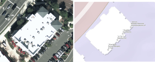
Using aerial imagery in combination with street-level imagery results in an accurate placement of business accounts on the parcel/building. This vastly improve your cartographic representation of the basemap.
Using aerial imagery in combination with street-level imagery results in an accurate placement of business accounts on the parcel/building. This vastly improve your cartographic representation of the basemap.
