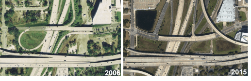
Aerial imagery is used to view changes in traffic patterns, transportation planning and study the impact on property values.
Aerial imagery is used to view changes in traffic patterns, transportation planning and study the impact on property values.
