Many assessor offices have made investments in acquiring aerial imagery. This is a primer on how to make the most out of your investments. If you have the need to manage any phase of your imagery project and simply do not have the time or resources, please contact us – our team has completed over 18 county-wide aerial projects (about $7million in value) and managed at least 6 different vendors. We can also help you establish an inter-local cost-sharing partnership with other agencies.
(click on the image to view it as a full-size photo gallery)
Example of 3″ pixel resolution, 2′ horizontal accuracy ortho imagery used as a base layer for cadastral mapping
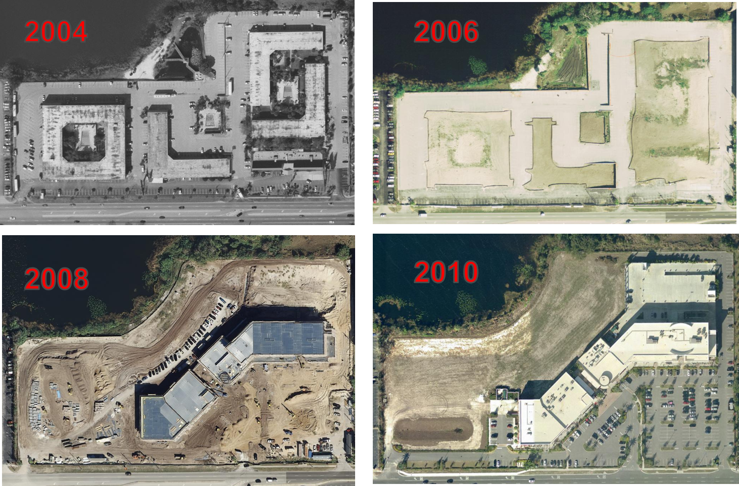
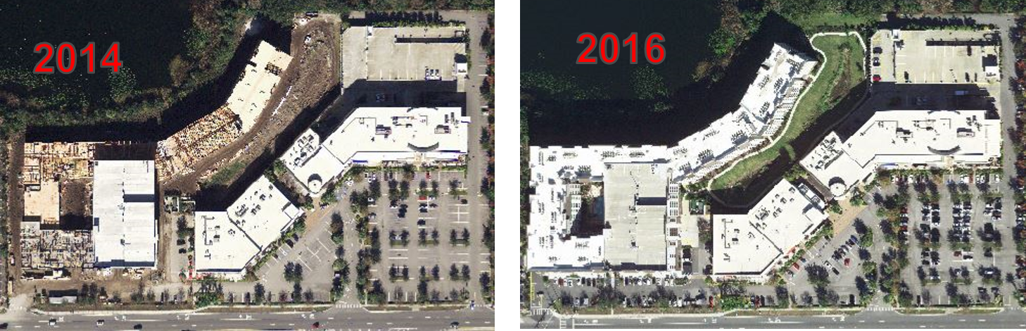
Basic change detection delivered via online GIS application – users can transition between the years using a slider
…or compare current year with prior years in a side-by-side view
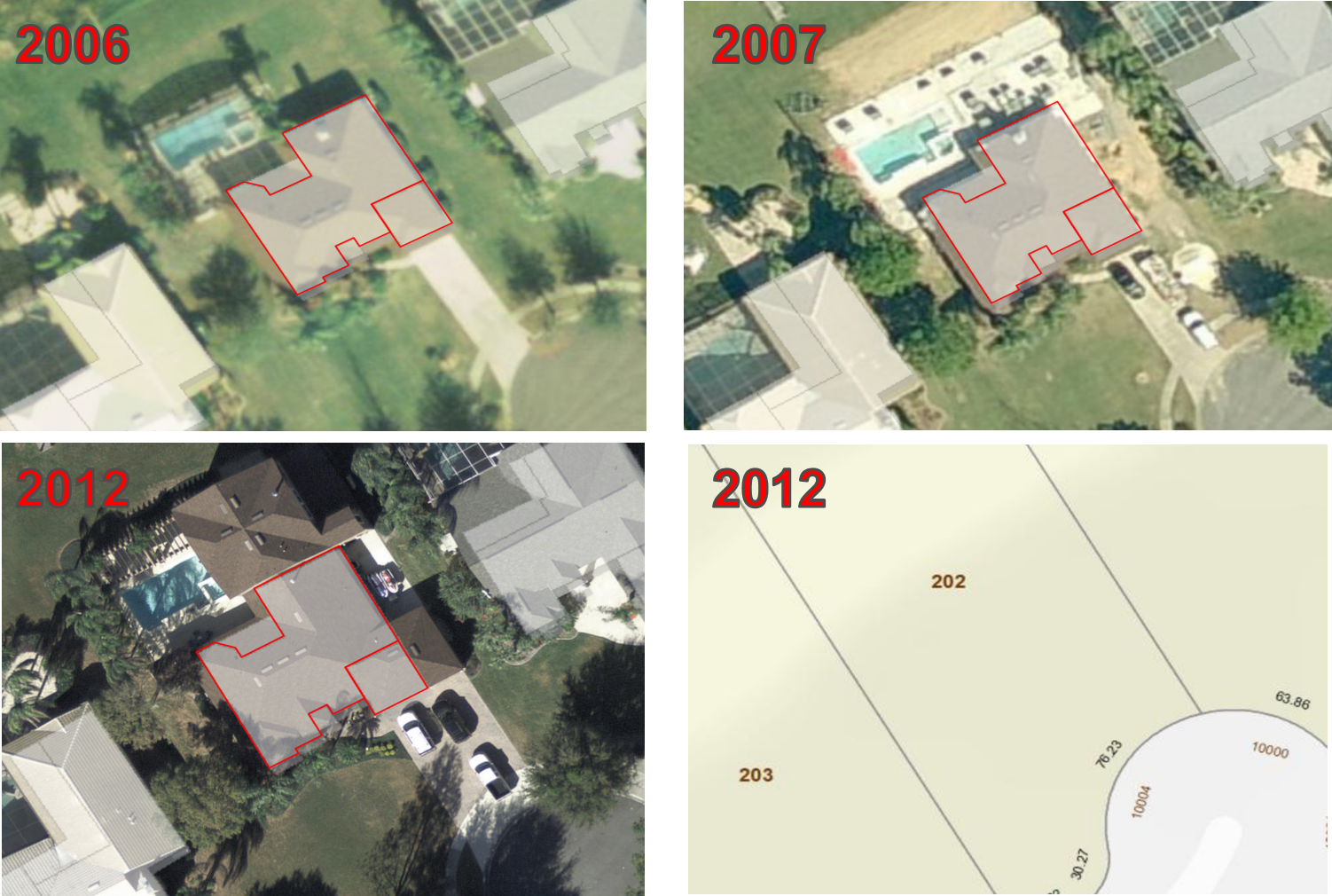
Imagery is perhaps the most effective way to sketch building outlines (not to confuse with building sketches from as built plans). These outlines enhance the cartographic representation of your GIS maps.
Not only can you detect changes using aerial imagery, but also, with a little bit of effort you can validate the accuracy of your sketches and find missing additions, as seen in the example above.
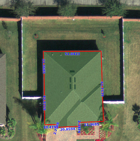
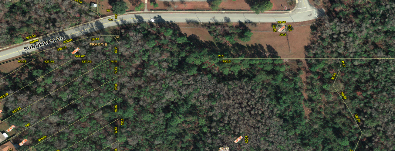
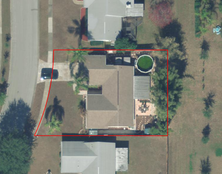
Imagery can also be used to quickly validate the build area – in this example there is 2.14% variance between field measurement and onscreen measurement.
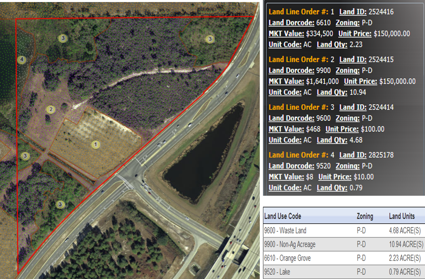
Another unique use for the assessor is to outline the multiple use of land on a parcel. Having this level of granularity makes your assessment more fair and equitable.
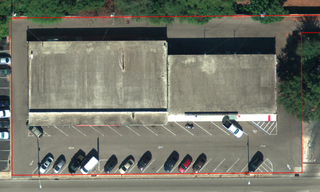
You can easily count the number of paved parking spaces on this commercial property. Are you considering paved parking space in your cost approach?
Using aerial imagery in combination with street-level imagery results in an accurate placement of business accounts on the parcel/building. This vastly improve your cartographic representation of the basemap.
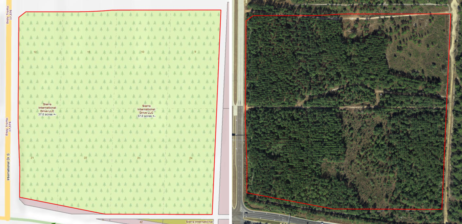
Example of using imagery to review/validate bonafide agriculture use. It appears there is approximately 32.17 acres of timber planted and 4.84 acres of raw land.
Aerial imagery is critical for emergency response. Assessors are primarily responsible for damage assessment and would benefit from latest imagery. Make sure to negotiate a natural disaster flight clause in your next contract
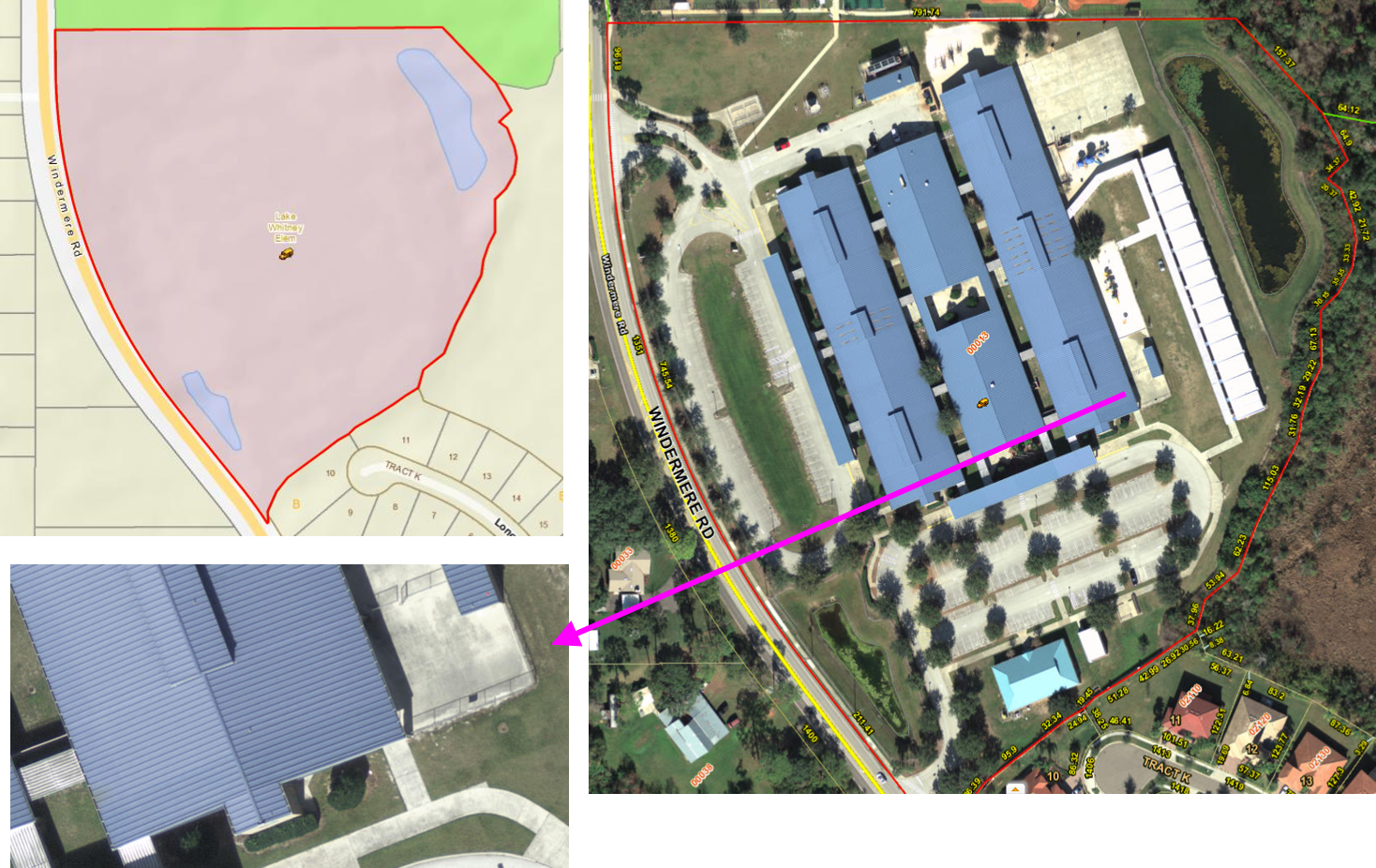
Public safety agencies routinely use assessor data as a situational awareness tool. The example shows a suburban school.
…another example of situational awareness, but in a rural setting
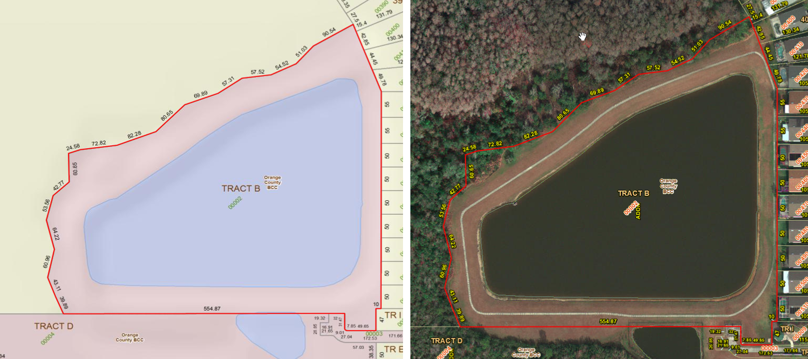
Public works agency uses the assessor base data (parcels, imagery) for various applications – shown here is the storm-water runoff and retention area example.
Code enforcement agencies use the assessor websites to find code violations and to support their findings.
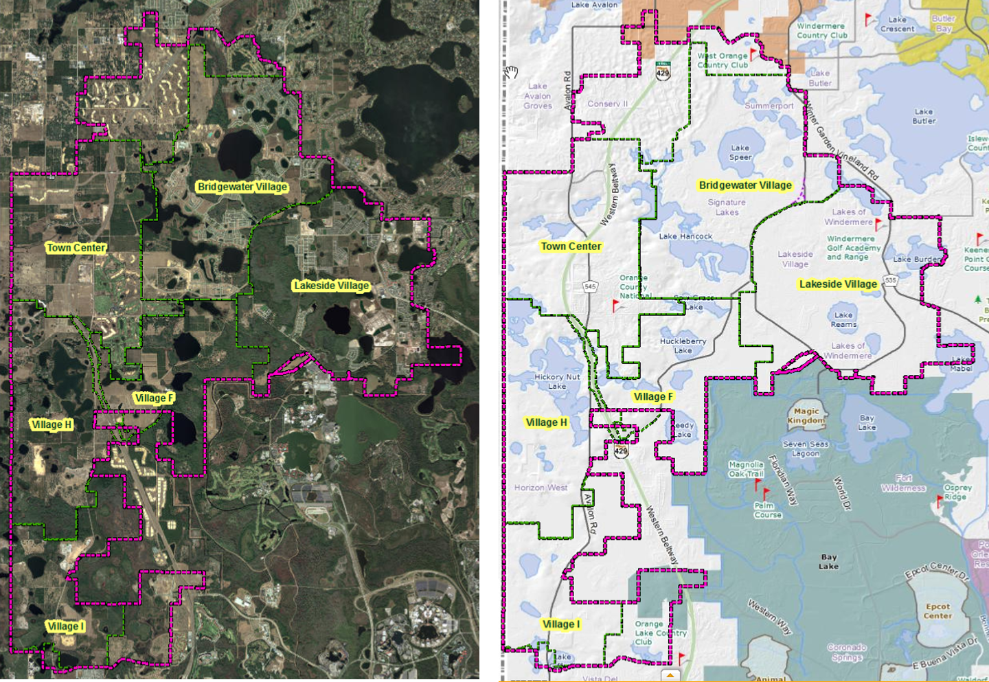
Example of using aerial photos for regional planning
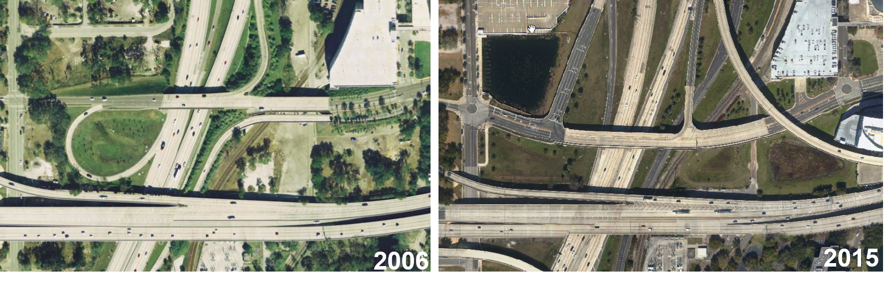
Aerial imagery is used to view changes in traffic patterns, transportation planning and study the impact on property values.
In this example, aerial imagery was used (with the parcel outline in red) by the media in the famous Casey Anthony case.